Blue Ridge Trail
Hiking Trails
 View Photos (18) View Photos (18)
|
 View Maps (2) View Maps (2)
|
Blue Ridge Trail Information |
| Length: | 2.0 miles |
| Type: | One Way |
| Gain/Loss: | +/-1050' |
| Difficulty: | Moderate |
| Trailhead: | Big Pines / Blue Ridge Campground |
| Location: | West of Wrightwood |
|
Blue Ridge Trail Elevation Profile

*Elevation data provided by National Geographic Topo!*
Blue Ridge Trail Description
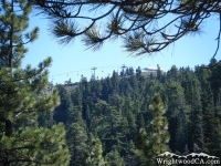
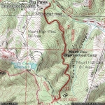
The Blue Ridge Trail is located west of the town of Wrightwood, near the exit of the Mt High West parking lot in the Big Pines area. The trail starts off by crossing a wood bridge over a creek filled with the runoff of melting snow from Mountain High. You then traverse up the side of Blue Ridge through oak trees, then later pine trees. Toward the top of the hike you can see the chair lifts going up Mountain High's East Resort. At the end of the trail is the Blue Ridge Campground. Overall, this trail isn't terribly difficult (easier than the Acorn Trail), and it is under the shade of trees almost the whole time. The Blue Ridge Trail is definitely one of the more pleasant hikes in the Wrightwood area.
Directions to Blue Ridge Trail from Wrightwood
From Wrightwood, take Hwy 2 westbound, approximately 1 mile past Mountain High's East Resort, to the Big Pines Visitor Center. The trail head is located on the south side of Hwy 2, at the bottom of the exit road to Mountain High's West Resort.
Don't forget to display a National Forest Adventure Pass in the windshield of your vehicle.
Blue Ridge Trail Photos
Blue Ridge Trail Maps
|