Pine Mountain Ridge Trail
Hiking Trails
 View Photos (13) View Photos (13)
|
 View Maps (2) View Maps (2)
|
Pine Mountain Ridge Trail Information |
| Length: | 2.6 miles |
| Type: | One Way / Connecting |
| Gain/Loss: | +795'/-0' |
| Difficulty: | Moderate |
| Trailhead: | Fish Fork Trail |
| Location: | South of Wrightwood |
|
Pine Mountain Ridge Trail Elevation Profile

*Elevation data provided by National Geographic Topo!*
Pine Mountain Ridge Trail Description
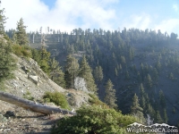
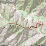
The Pine Mountain Ridge Trail is located south of Wrightwood along Pine Mountain Ridge. The trail head starts just above the entrance to Lupine Campground, in Prairie Fork. The Pine Mountain Ridge Trail climbs to the top of the ridge along with the Fish Fork Trail. From here, it continues west along the ridge. The Pine Mountain Ridge Trail offers views of both Prairie Fork and Fish Fork, as well as the San Gabriel River Basin (East Fork). Most of the trail is pretty well maintained, especially when closer to the campground. This is a good day hike if you are staying in Lupine or Cabin Flat Campgrounds.
Directions to Pine Mountain Ridge Trail from Wrightwood
Take Hwy 2 westbound from Wrightwood, past Big Pines and up to Inspiration Point. From Inspiration take Access Road 3N06 westbound, past both of Mountain High's Ski Resorts and past both Blue Ridge and Guffy Campgrounds to its intersection with Access Road 3N39. Take Access Road 3N39 southbound to Lupine Campground, where you will find the Fish Fork Trail head.
Don't forget to display a National Forest Adventure Pass in the windshield of your vehicle.
Pine Mountain Ridge Trail Photos
Pine Mountain Ridge Trail Maps
|